Map of Turkey — Where Türkiye Is, Its Cities, Regions & Landmarks
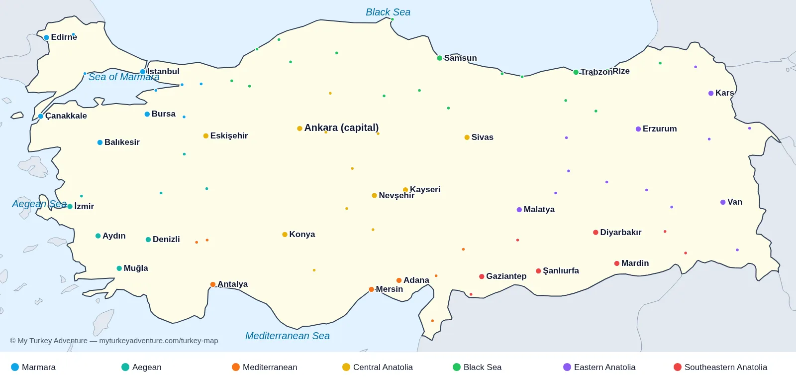
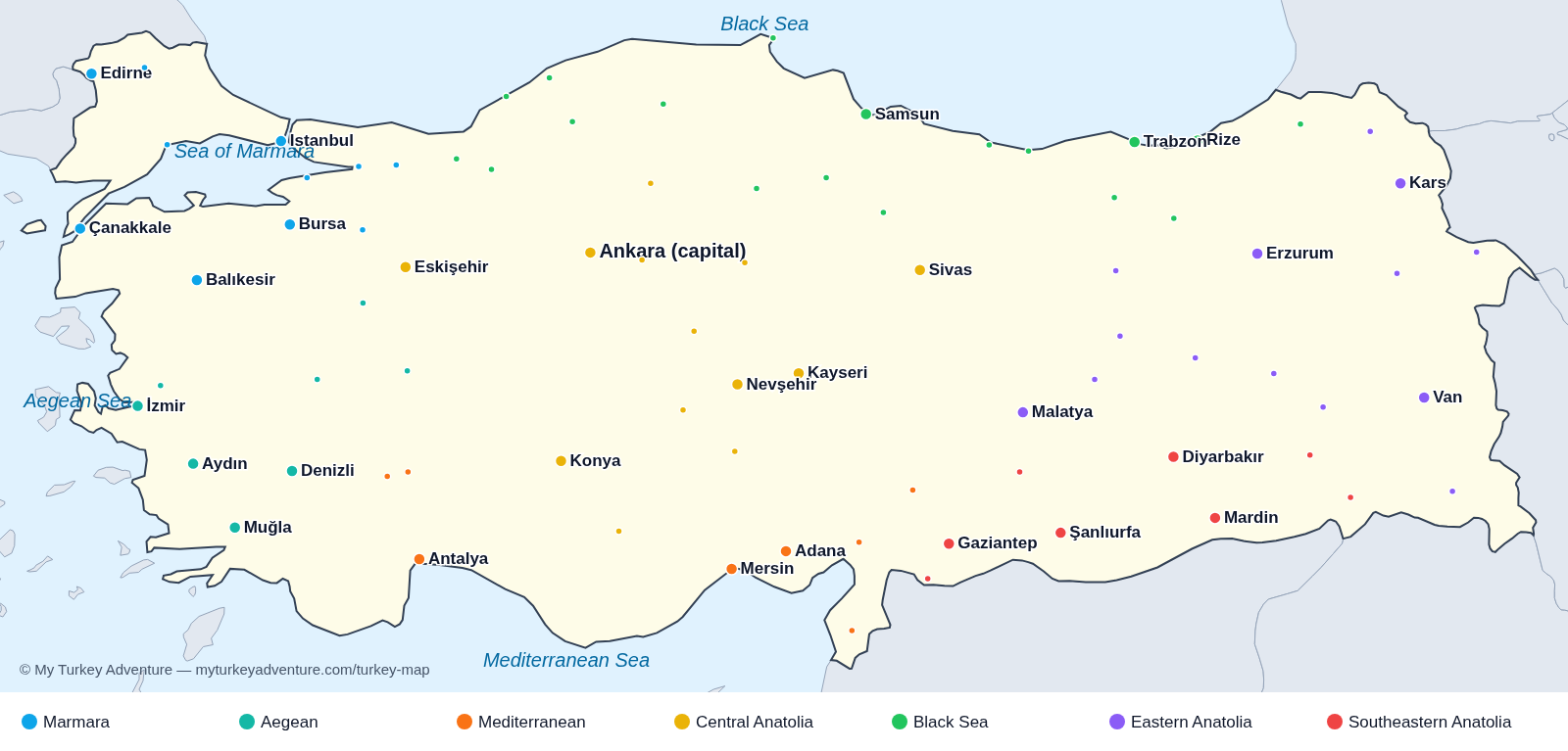
Where is Turkey? Türkiye straddles two continents: about 3% of its land (East Thrace, including half of Istanbul) lies in southeastern Europe and 97% (Anatolia) in western Asia. The Bosphorus, the Sea of Marmara and the Dardanelles separate the two parts.
Bordering countries: Greece and Bulgaria to the northwest; Georgia, Armenia, Azerbaijan (Nakhchivan) and Iran to the east; Iraq and Syria to the southeast. Four seas surround it: the Black Sea (north), the Sea of Marmara, the Aegean Sea (west) and the Mediterranean Sea (south).
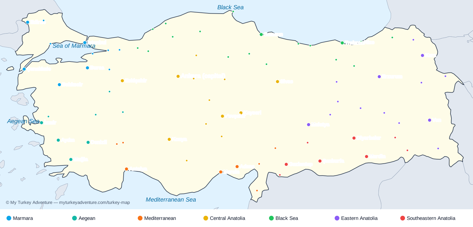
The 7 geographical regions of Turkey on the map: Marmara (Istanbul, Bursa, Edirne, Çanakkale), Aegean (Izmir, Ephesus, Pamukkale, Bodrum), Mediterranean (Antalya, Fethiye, Kaş, Adana), Central Anatolia (Ankara, Cappadocia, Konya), Black Sea (Trabzon, Rize, Uzungöl, Amasra), Eastern Anatolia (Van, Kars, Erzurum, Mount Ararat) and Southeastern Anatolia (Şanlıurfa, Göbekli Tepe, Mardin, Gaziantep, Mount Nemrut).
Capital and major cities: Ankara is the capital; Istanbul is the largest city (about 15.7 million people), followed by Ankara, Izmir, Bursa and Antalya. Türkiye covers about 783,500 km² and runs on UTC+3 all year.
How to use this interactive Turkey map: switch between Popular Destinations, Historical Landmarks (filtered by era, from Göbekli Tepe to the Ottoman period) and Off-the-Beaten sites, then click places to build a route. Nights, realistic drive times and domestic flights are calculated for you, and the route can be shared or turned into a free private-trip quote.
Main tourist places on the map: Istanbul (Hagia Sophia, Topkapı Palace), Cappadocia (fairy chimneys, hot-air balloons), Ephesus, Pamukkale travertines, Antalya and the Turquoise Coast, Göbekli Tepe and Şanlıurfa, Mount Nemrut, Lake Van and the Black Sea highlands.
Marmara Region of Turkey (11 provinces)
- Balıkesir — Ayvalık islands, Mount Ida and Aegean olive groves. Show on the map
- Bursa — First Ottoman capital, silk bazaars and Uludağ. Show on the map
- Çanakkale — Dardanelles, Gallipoli and nearby Troy. Show on the map
- Edirne — Selimiye Mosque and Ottoman frontier heritage. Show on the map
- Istanbul — Bosphorus ferries, Hagia Sophia and layered neighbourhoods. Show on the map
- Bilecik — Early Ottoman history and the Söğüt area. Show on the map
- Kırklareli — Thracian villages and the İğneada floodplain forests. Show on the map
- Kocaeli — İzmit Gulf, Hereke carpets and lakeside escapes. Show on the map
- Sakarya — Sapanca Lake and the surrounding green hills. Show on the map
- Tekirdağ — Sea of Marmara waterfront and Thracian vineyards. Show on the map
- Yalova — Thermal springs and Marmara coast. Show on the map
Aegean Region of Turkey (8 provinces)
- Aydın — Ancient Aphrodisias and the Büyük Menderes valley. Show on the map
- Denizli — Gateway to Pamukkale's travertines and Hierapolis. Show on the map
- İzmir — Kordon waterfront, Kemeraltı bazaar and Ephesus access. Show on the map
- Muğla — Aegean bays, Bodrum peninsula and coastal routes. Show on the map
- Afyonkarahisar — Thermal springs, hilltop fortress and regional cuisine. Show on the map
- Kütahya — Traditional tiles and historic old-town houses. Show on the map
- Manisa — Spil Mountain and Ottoman-era mosques. Show on the map
- Uşak — Ulubey Canyon and Anatolian textile traditions. Show on the map
Mediterranean Region of Turkey (8 provinces)
- Adana — Stone Bridge, riverside walks and Adana kebab. Show on the map
- Antalya — Kaleiçi old town, Roman ruins and the Mediterranean coast. Show on the map
- Mersin — Mediterranean waterfront and nearby ancient sites. Show on the map
- Burdur — Sagalassos ancient city and Lake Salda. Show on the map
- Hatay — Antakya's layered heritage and regional cuisine. Show on the map
- Isparta — Rose fields and Eğirdir Lake. Show on the map
- Kahramanmaraş — Historic bazaars and the region's famous ice cream. Show on the map
- Osmaniye — Karatepe-Aslantaş archaeological site. Show on the map
Central Anatolia Region of Turkey (13 provinces)
- Ankara — Anatolian Civilisations Museum and Anıtkabir. Show on the map
- Eskişehir — Porsuk riverfront and Odunpazarı's historic houses. Show on the map
- Kayseri — Seljuk monuments and gateway to Cappadocia. Show on the map
- Konya — Mevlana Museum and Seljuk-era monuments. Show on the map
- Nevşehir — Cappadocia's valleys, cave towns and underground cities. Show on the map
- Sivas — Seljuk madrasas and Divriği's monumental complex. Show on the map
- Aksaray — Ihlara Valley and the caravanserais of the central plateau. Show on the map
- Çankırı — Salt Cave and historic Anatolian townscape. Show on the map
- Karaman — Karaman Castle and early Anatolian heritage. Show on the map
- Kırıkkale — Central Anatolian plateau and Kızılırmak landscapes. Show on the map
- Kırşehir — Ahi Evran heritage and Cacabey Madrasa. Show on the map
- Niğde — Aladağlar mountain gateway and Seljuk landmarks. Show on the map
- Yozgat — Çamlık National Park and central plateau towns. Show on the map
Black Sea Region of Turkey (18 provinces)
- Rize — Tea terraces and the Kaçkar Mountains. Show on the map
- Samsun — Black Sea promenade and Türkiye's independence history. Show on the map
- Trabzon — Sumela Monastery and Black Sea mountain scenery. Show on the map
- Amasya — Pontic royal tombs above the Yeşilırmak river. Show on the map
- Artvin — Forest valleys, mountain villages and Karagöl. Show on the map
- Bartın — Amasra's historic harbour on the Black Sea. Show on the map
- Bayburt — Old town, hilltop castle and eastern highlands. Show on the map
- Bolu — Abant Lake, forests and mountain trails. Show on the map
- Çorum — Hattusa's Hittite heritage and local museums. Show on the map
- Düzce — Waterfalls and forest walks between Istanbul and Bolu. Show on the map
- Giresun — Black Sea island and hazelnut-covered hills. Show on the map
- Gümüşhane — Karaca Cave and mountain scenery. Show on the map
- Karabük — Safranbolu's UNESCO-listed Ottoman streets. Show on the map
- Kastamonu — Old timber houses and the Küre Mountains. Show on the map
- Ordu — Boztepe viewpoint and Black Sea coastline. Show on the map
- Sinop — Walled harbour on Türkiye's northern Black Sea point. Show on the map
- Tokat — Historic old town and the Ballıca Cave region. Show on the map
- Zonguldak — Coal-mining heritage and rugged Black Sea coves. Show on the map
Eastern Anatolia Region of Turkey (14 provinces)
- Erzurum — Seljuk madrasas and high-altitude winter landscapes. Show on the map
- Kars — Ani's medieval ruins and distinctive stone architecture. Show on the map
- Malatya — Apricot orchards and Arslantepe's ancient mound. Show on the map
- Van — Lake Van, Akdamar Church and the old citadel. Show on the map
- Ağrı — Mount Ararat and the road to İshak Paşa Palace. Show on the map
- Ardahan — Çıldır Lake and high eastern plateaus. Show on the map
- Bingöl — Mountain landscapes and highland lakes. Show on the map
- Bitlis — Seljuk architecture beside Lake Van. Show on the map
- Elazığ — Harput citadel and views across the Euphrates. Show on the map
- Erzincan — Mountain valleys and the upper Euphrates. Show on the map
- Hakkâri — Cilo mountains and remote highland landscapes. Show on the map
- Iğdır — Ararat views and the eastern borderlands. Show on the map
- Muş — Murat river plain and eastern highland scenery. Show on the map
- Tunceli — Munzur Valley and mountain rivers. Show on the map
Southeastern Anatolia Region of Turkey (9 provinces)
- Diyarbakır — Basalt city walls and the Tigris river. Show on the map
- Gaziantep — Zeugma mosaics, copper bazaar and regional food. Show on the map
- Mardin — Honey-coloured stone terraces above Mesopotamia. Show on the map
- Şanlıurfa — Old bazaars, Balıklıgöl and nearby Göbekli Tepe. Show on the map
- Adıyaman — Gateway to Mount Nemrut and the Kommagene kingdom. Show on the map
- Batman — Hasankeyf's heritage beside the Tigris. Show on the map
- Kilis — Stone streets and southeastern food traditions. Show on the map
- Siirt — Tillo heritage and the Botan valley. Show on the map
- Şırnak — Cudi Mountain and the upper Tigris landscape. Show on the map